Iran’s Khayyam Satellite Empowers Precise Weather Monitoring Nationwide
TEHRAN (Tasnim) – Leveraging data from the Khayyam satellite, the Iranian Space Agency has been closely monitoring rainfall and water resources across various regions in the country.
The agency has been capturing detailed images of multiple locations throughout the country and provided a comprehensive report to Iranian Crisis Management Organization.
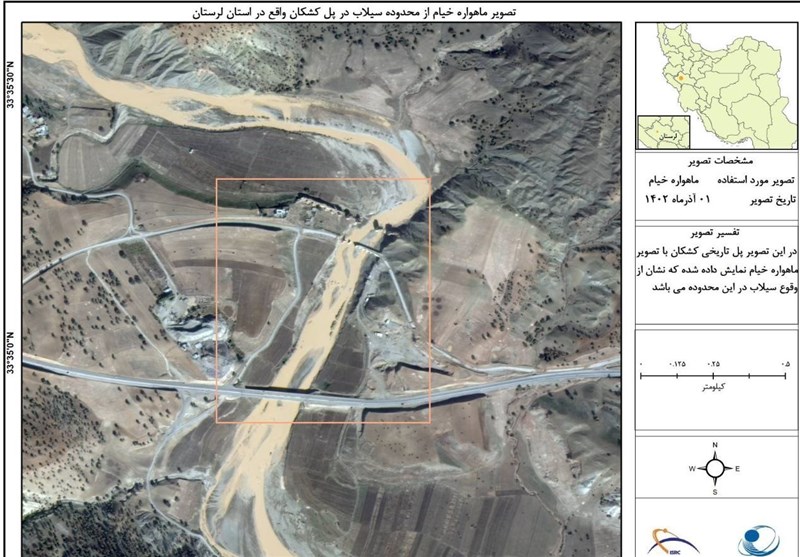
Utilizing Khayyam satellite data, the Iranian Space Agency meticulously monitored different parts of the country, focusing on Lorestan and Khuzestan provinces, notably the city of Mamulan and its surrounding villages.
The satellite, following ground station commands, precisely captured images of these areas. Experts from the Iranian Space Agency and the Space Research Institute meticulously analyzed the gathered data from these images.
The data facilitated a comprehensive assessment of critical zones along the Karkheh and Keshkan rivers in Lorestan and Khuzestan provinces, pinpointing areas vulnerable to river overflow following the recent rainfall.
The assessment report has been shared with the Crisis Management Organization, empowering authorities to effectively address affected regions and strategically plan for future rainfall occurrences.